

About Dubbaka
Map of Dubbaka
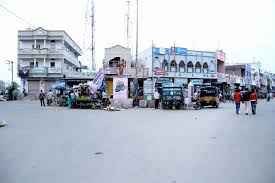
Dubbaka Municipality was constituted in 31 January 2013 and is classified as a second grade municipality. The jurisdiction of the civic body is spread over an area of 26.40 km2
Key Features
Dubbak consist of 41 Villages and 32 Panchayats . Yellapur is the smallest Village and Dubbak is the biggest Village . It is in the 575 m elevation(altitude) . This Place is in the border of the Medak District and Karimnagar District. Karimnagar District Mustabad is North towards this place . Medak , Hyderabad , Warangal (Orugallu) , Bidar , Medaram are the near by Important tourist destinations to see. Telugu is the Local Language here. Total population of Dubbak Mandal is 70,594 living in 14,160 Houses, Spread across total 41 villages and 32 panchayats . Males are 35,120 and Females are 35,474
Dubbak is very popular for its places of worships which bring a large number of tourist from in and around Dubbak mandal towards its grounds every year.
Also Check Below Links


Raghunandan Rao
MLA,Telangana
| Members of Legislative Assembly | ||
|---|---|---|
| Duration | Name of M.L.A | Party Affiliation |
| 2009-14 | Cheruku Muthyam Reddy | Indian National Congress |
| 2014-2020 | Solipteta Rama Linga Reddy | Telangana Rashtra Samithi |
| 2020- | Raghunandan Rao | Bharatiya Janata Party |